Community finder
Perth
Boorloo (Perth) and Walyalup (Fremantle) make up the Greater Perth region, from Wanneroo to Rockingham on the west coast, more than 120+ kilometres of shoreline.
South-West Coast
The South-West Coast area covers a large swathe of coastline in the South Australia region, from Penong to the border of Western Australia.
Shepparton
The Shepparton area spans the Murray River, from Cohuna to Albury-Wodonga. The area includes the Yorta Yorta traditional lands, which cover some 20,000 square kilometers.
Sydney - Wollongong region
The Sydney - Wollongong region is the Country of a number of First Nations communities, including Gadigal and Dharug peoples.
Ugar Island (Stephen Island)
Ugar Island is situated in the eastern section of Torres Strait, near the Great Barrier Reef and North of Coconut / Poruma Island and North West of Murray Island and Darnley Island.
Maroochydore (Gubbi Gubbi Country)
The Gubbi Gubbi people are the Traditional Custodians of the land located in South East Queensland, located in the Moreton Bay, Sunshine Coast, Noosa, Maryborough and Gympie region.
K'gari (Fraser Coast)
K'gari is in south eastern Queensland and is part of the Fraser Coast region.
Balranald - Wentworth - Surrounds
The Balranald - Wentworth - Surrounds area is in far western New South Wales, sharing borders with South Australia and Victoria.
Kakadu - Marrakai - Surrounds
The Kakadu - Marrakai - Surrounds area is a vast area of 2.5 million square kilometers east of Darwin in the Northern Territory.
Barunga
Barunga is in the Nyirranggulung Ward and is located 80 kilometres south-east of Katherine on the Central Arnhem Road. Barunga may also be called Bamyili.
Kununurra (Kinunnurra)
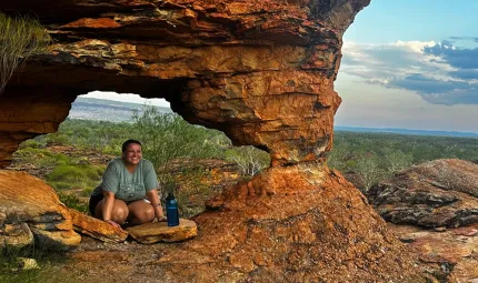
Located on the traditional lands of the Miriwoong, Kununurra is a town in far northern Western Australia located at the eastern extremity of the Kimberley.
Numbulwar
Numbulwar is located on the western coast of the Gulf of Carpentaria and approximately 250 km south west of Nhulunbuy in the Northern Territory.
Kubin
Kubin is located on the south side of Moa Island in the Torres Strait.
Dhuruputjpi
Dhuruputjpi is 211 kms southwest of Yirrkala, East Arnhem Land and inland of Blue Mud Bay in the Northern Territory.
Umuwa
Umuwa is a service centre for the Anangu Pitjantjatjara Yankunytjatjara Lands and is located 25 kms south of Pukatja (Ernabella) and 35kms north of Kaltjiti (Fregon).
Imangara (Murray Downs)
Imangara is located 207 km south east of Tennant Creek and accessed via the Ali Curung road.
Parnngurr
Parnngurr is a remote Aboriginal community about 370kms East of Newman on the edge of the Great Sandy Desert in Western Australia.
Gununa
Gununa is a community situated on the south-west of Mornington Island, the largest in the Wellesley Islands group in the Gulf of Carpentaria.
Maralinga Tjarutja (Oak Valley)
Maralinga Tjarutja (Oak Valley) is a community located on the southern fringe of The Great Victoria Desert, approximately 516kms northwest of Ceduna and approximately 320km north of Yalata by 4WD track.
Kalkaringi (Kalkarindji) - Daguragu
Kalkaringi is a community on the Buntine Highway, located about 460 kilometres south-west of Katherine in the Northern Territory with Daguragu 8 kilometres north-west of Kalgaringi.
Yirrkala
Yirrkala is a coastal community in the East Arnhem region of the Northern Territory and is about 18kms south-east of Nhulunbuy.
Warmun
Warmun is located on the Great Northern Highway 847 km east of Broome and 197 km south of Kununurra.
Gapuwiyak
Gapuwiyak is on the shore of Lake Evella in north-east Arnhem Land, about 500 km east of Darwin and 120 km west of Nhulunbuy.
Ramingining
Ramingining is a mainland community located to the west of the Glyde River in East Arnhem Land about 580 km east of Darwin and 30 km inland.
Iama (Yam) Island
Iama Island (also Yama, Yama or Turtle-backed Island) is an island of the Bourke Isles, 100km northeast of Thursday Island. The area measures about two square kilometres.
Erub (Darnley) Island
Erub (Darnley) Island is an island formed by volcanic action and situated in the eastern section of the Torres Strait, near the Great Barrier Reef and just south of the Bligh entrance.
Angurugu
Angurugu is situated halfway down the western coast of Groote Eylandt, on the banks of the Angurugu River.
Yuendumu
Yuendumu is on the edge of the Tanami Desert, 290km north west of Alice Springs along the Tanami Highway, which branches off the Stuart Highway 25 km north of Alice Springs.
Santa Teresa (Ltyentye Apurte)
Santa Teresa is an Eastern Arrernte community 85km south east of Alice Springs on Arrernte country.
Ngukurr
Ngukurr is a community on the Roper Highway approximately 3.5 hours east of Katherine.
Titjikala
Titjikala is an Aboriginal community around 130km south of Alice Springs and on the Hugh River in the Simpson Desert.
Warrwa
The Warrwa community is a group of people who share the Karmulinunga Reserve area of Derby.
Binjari
Binjari is a small community in the Top End about 15 minutes from Katherine down the Victoria Highway.
Maningrida
Maningrida is located approximately 500km east of Darwin and 300km northeast of Jabiru in Arnhem Land at the mouth of the Liverpool River.
Borroloola
Borroloola is a remote community on the Carpentaria Highway about 7 hours drive southeast of Katherine in the Northern Territory.
Jilkminggan
Jilkminggan is a community approximately 140 kilometres southeast of Katherine in the Northern Territory and east of Mataranka.
Galiwin'ku
Galiwin'ku is a Yolnu community on Elcho Island located approximately 550 km northeast of Darwin.
Kalumburu
Kalumburu Community is the northernmost settlement in Western Australia, about 270km north of Gibb River Road.
Nepabunna (Nipapanha)
Nepabunna is a community in the Northern Flinders Ranges of South Australia, just outside the south west boundary of the Gammon Ranges approximately 600km north of Adelaide.
Punmu
Punmu is located 640 km south east of Port Hedland in the Pilbara Region of Western Australia and is one of the most remote Aboriginal communities in Australia.
Djarindjin - Lombadina
Djarindjin - Lombadina is a community on the Dampier Peninsula in the Kimberley Region of Western Australia.
Pukatja (Ernabella)
Pukatja (Ernabella) Community is located in South Australia in the Musgrave Ranges about 30 km south of the Northern Territory border.
Goondiwindi
Goondiwindi is on the border of Queensland and New South Wales, located in Queensland, Australia.
Kunawarritji
Kunawarritji is located on the Canning Stock Route at Well 33.
Woorabinda
Woorabinda is a town in central Queensland, 170 kilometres south-west of Rockhampton.
Raukkan
Raukkan is an Aboriginal community located on the shore of Lake Alexandrina, 80km southeast of Adelaide. The church at Raukkan is depicted on the Australian $50 note.
Papunya (Warrumpi)
Papunya is a small community 240km northwest of Alice Springs within the MacDonnell Regional Council area of the Northern Territory.
Mutitjulu
Mutitjulu is situated near Uluru within the Uluru-Kata Tjuta National Park, 470km southwest by road from Alice Springs.
Horn Island (Ngurupai)
Horn Island (Ngurupai) lies in the Torres Strait near Thursday Island around 40 kilometres from the northern tip of Cape York, Queensland.
Badu Island (Mulgrave Island)
Badu Island is located in the Torres Strait around 60 kilometres north of Thursday Island, Queensland.
Mer (Murray Island)
Mer (also known as Murray Island) is the most eastern island in the Torres Strait, 800km north of Cairns. Mer, Erub and Ugar islands are known as the Murray Group of islands.
Saibai Island
Saibai Island is a small island located in the northwestern Torres Strait, around 140 kilometres from the northern tip of Cape York, Queensland.
Seisia
Located on the tip of Cape York Peninsula, over 2700 kilometres north west of Brisbane, Seisia is the most northern community on the Australian mainland.
Thursday Island (Waiben)
Traditionally the land of the Kaurareg Aboriginal people, Thursday Island is located 30 kilometres form the northern tip of Cape York, Queensland.
Yarrabah
Yarrabah is an Aboriginal community located 55 kilometres east of Cairns in Far North Queensland.
Mimili
Mimili is a community in the APY Lands of South Australia about 70 kilometres West of the Stuart Highway.
Injinoo
Injinoo (also known as Cowal Creek or Small River) is one of the 5 communities forming the Northern Peninsula Area (NPA).
Brewarrina
Brewarrina is a town on the banks of the Barwon River in northwest New South Wales, 800 kilometres southwest of Brisbane and 800 kilometres northwest of Sydney.
Doomadgee
Doomadgee is a community in the northwest of Queensland, around 630 kilometres by road to Mount Isa, and 140 kilometres east of the Northern Territory border.
Cherbourg
Cherbourg is a town in southeast Queensland, 267 kilometres north-west of Brisbane.
Palm Island (Bwgcolman)
Palm Island (also known as Bwgcolman) is an Aboriginal community approx 65 kilometres northeast of Townsville in northern Queensland.
Wadeye
Wadeye is a large remote Aboriginal community 420 kilometres by road south-west of Darwin.
Bamaga
Bamaga is a town located on the northern tip of Cape York, Queensland, 1000 kilometres north west of Cairns.
New Mapoon
New Mapoon is a community near the tip of Cape York, 1000 kilometres north west of Cairns.
Amata
Amata is a community in the extremely remote Aṉangu Pitjantjatjara Yankunytjatjara (APY) Lands in South Australia, 40km south of the Northern Territory border and around 250km west of the Stuart Highway.
Weipa
Weipa lies on the west coast of Cape York, about 200 kilometres south of the tip of Australia and 800 kilometres north west of Cairns by road.
Pormpuraaw
Pormpuraaw is a community situated on Cape York’s west coast, just south of the Edward River and about 660 kilometres northwest of Cairns.
Napranum
Napranum is a community on the west coast of Cape York, Queensland, six kilometres south of Weipa and 800 kilometres north west of Cairns.
Mapoon
Mapoon (also refered to as Old Mapoon) is an Aboriginal community in Cape York, eighty kilometres north of Weipa on the mouth of the Wenlock River, and about 700 km north west of Cairns.
Kowanyama
Kowanyama lies on the west coast of Cape York, 600 kilometres northwest of Cairns.
Coen
Coen is a small community situated in central Cape York in Far North Queensland, 580 kilometres north of Cairns.
Aurukun
Aurukun is a remote community in Far North Queensland around 800 kilometres northwest of Cairns or about two hours’ drive from Weipa.
Yungngora
Yungngora is an Aboriginal community in the Kimberley region of northern Western Australia, around 280 kilometres east-south-east of Broome and 100 kilometres southwest of Fitzroy Crossing.
Yalata
Yalata is an Aboriginal community located on the far west coast of South Australia, 200km west of Ceduna.
Wurrumiyanga
Wurrumiyanga is an Aboriginal community located on the southeast corner of Bathurst Island, part of the Tiwi Islands, 80 kilometres north west of Darwin.
Wugularr (Beswick)
Beswick is on the banks of the Waterhouse river approximately 116 km, South East of Katherine and 31kms from the Barunga Community.
Wiluna
Wiluna sits 950 kilometres north east of Perth and 534 km north of Perth in the traditional lands of the Martu people in central Western Australia.
Wilcannia
Wilcannia is a small town in Far West New South Wales, located on the Darling River 195 kilometres east of Broken Hill.
Murrin Bridge
Murrin Bridge is an Aboriginal community 320 km south west of Dubbo in central west New South Wales. It is located in the Cobar Shire, 12 kilometres north of Lake Cargelligo, on the other side of the Lachlan River (Lachlan Shire).
Mapuru
Mapuru is a community 500km east of Darwin, in northeast Arnhem Land, Northern Territory.
Lockhart River
Lockhart River is a community located on the east coast of Cape York, around 800 kilometres north of Cairns.
Lightning Ridge
Lightning Ridge is a remote town in Yuwaalaraay country in northwest New South Wales, near the Queensland border and 770 kilometres northwest of Sydney.
Koonibba
Koonibba is located on South Australia’s Eyre Peninsula, 800km west of Adelaide and 40km northwest of Ceduna.
Jigalong
Jigalong is a community in the Pilbara region of Western Australia, around 1250 kilometres northeast of Perth and 520 kilometres southeast of Port Hedland on the western edge of the Little Sandy Desert.
Blackstone (Papulankutja)
Located about 900 kilometres west of Alice Springs and 1575 kilometres north east of Perth, Blackstone sits in the foothills of the Blackstone Ranges in the Ngaanyatjarra Lands.


